
AI Water Monitoring
Research-led monitoring of dam functionality and catchment dynamics, from a solar-powered computer-vision camera at the water point to 350,000 satellite images across Somaliland.
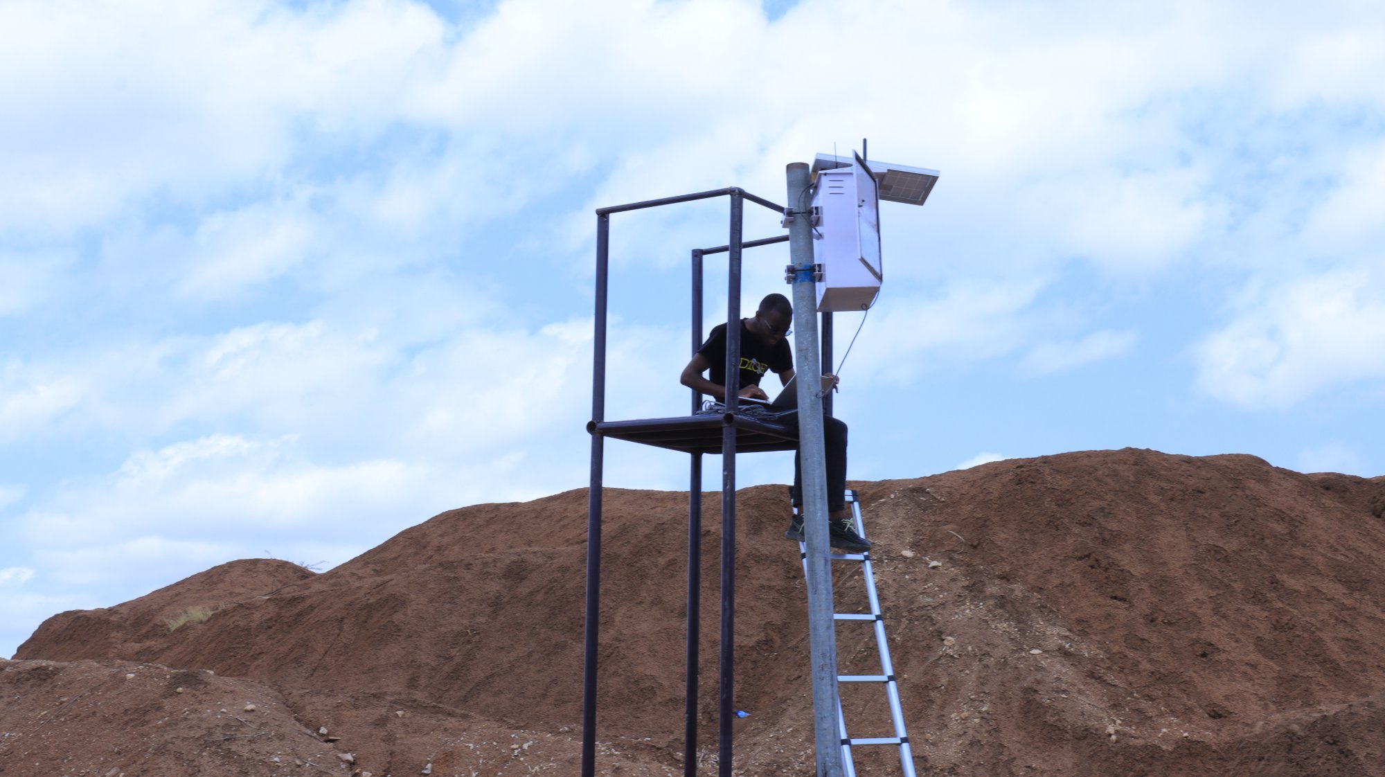
Installing a solar-powered Camel Cam monitoring tower, Somaliland.
You cannot maintain what you cannot see.
Our research team turns a scattered network of remote water points into something we can manage, combining on-site computer vision, which we call Camel Cam, with continent-scale satellite analysis.
Camel Cam is a solar-powered camera tower running a computer-vision model trained to recognise the things that matter at a dam, people, camels, goats and jerricans, and to transmit usage data to the cloud in real time.
Remote infrastructure fails quietly, and stays failed.
Water structures spread across a large region are expensive to inspect in person, and a silted dam or broken pump can go unnoticed for months. Worse, official records capture only a fraction of what exists, so investment is flying blind.
Our response
Replace irregular field checks with continuous data, on the ground and from space, so we know which dams work, how communities use them, and where to invest next.
Camel Cam
A solar-powered camera tower runs a computer-vision model that counts people, livestock and jerricans at the water point, measuring use in a verifiable, auditable way.
Satellite mapping
Analysis of 350,000 high-resolution images, tracking surface water over time, revealed over 1,000 hafir dams and 1,200 berkeds, five times more than official records.
Household surveys
The first large-scale (around 2,200 household) urban water survey in Hargeisa, to understand real demand.
Our impact
From the monitoring and research programme.
What we learnt
Monitoring is infrastructure.
A dam you cannot see is a dam you cannot maintain; continuous data replaced guesswork and irregular field checks.
Small dams matter.
Camel Cam showed visits spike in dry months, and villages with a dam reported far lower livestock losses than those without.
Quantity is not quality.
Satellite data found many mapped structures hold little or no water, so siting, features and maintenance matter as much as count.
Apply the method at scale.
Partnership, co-funding and operator enquiries start here.